


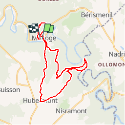
Maboge 15,5km - 13km
© OpenStreetMap contributors


--
Difficulty : Unknown


Length
15.5 km
Max alt
415 m
Uphill gradient
467 m
Km-Effort
22 km
Min alt
232 m
Downhill gradient
464 m
Boucle
Yes
Creation date :
2014-12-10 00:00:00.0
Updated on :
2014-12-10 00:00:00.0
--
Difficulty : Unknown
FREE GPS app for hiking
 SityTrail
IGN / Geographical institutes
SityTrail Plus
The world is yours!
About
Trail Walking of 15.5 km to be discovered at Wallonia, Luxembourg, La Roche-en-Ardenne. This trail is proposed by wandelgidszuidlimburg.
Description
More information on : http://www.wandelgidszuidlimburg.com


Positioning
Country:
Belgium
Region :
Wallonia
Department/Province :
Luxembourg
Municipality :
La Roche-en-Ardenne
Location:
Samrée
Start:(Dec)
Start:(UTM)
687569 ; 5560576 (31U) N.
Comments
⭐⭐⭐⭐⭐ Superbe randonnée au Pays des Deux Ourthes. Parcours 100% nature, mi-boisé, mi-campagnard offrant de beaux panoramas ardennais. ℹ balade n° 627